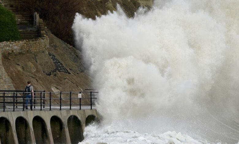
Storm Claudio is set to bring gusts up to 70 miles per hour with heavy rain across areas of southern England.
The Met Office has issued a yellow weather warning for wind for the south until 8am on Tuesday, saying the weather could risk causing disruption.
As well as strong winds, people across much of England and Wales face heavy rain as an additional yellow warning is in place until 8am on Tuesday which brings a threat of flooding and disruption to travel.
Storm Claudio’s move eastwards on Tuesday is expected to leave in its wake a showery day for much of the UK, with Wales and areas in southern and central England predicted to see the most frequent rainfall, the Met Office added.
Neil Armstrong, chief meteorologist, said: “The biggest impacts from Storm Claudio are expected in northern France, which is why is has been named as a system by Meteo-France.
“What it means for us in the UK is for some high winds to be possible along much of the southern coast of England.
“Some isolated and especially exposed coastal areas could see gusts in excess of 70mph, while much of the warning area will see gusts of between 50 and 60mph.”
The Met Office said winds are likely to be strongest along Irish Sea coastal areas, including western Wales, north west England and south west Scotland, as well as the east coast of Northern Ireland.
It has also issued a yellow weather warning for wind on Wednesday.
Deputy chief meteorologist Steven Keates said: “Within the warning area, gusts are expected of between 55 and 65mph. This is associated with low pressure moving towards the northwest of the UK, which is bringing with it some heavy rain on Wednesday, especially across parts of southwest Scotland, Cumbria and western Wales, although much of the UK will see some rain through the day.
“In addition to high winds in the warning area, many parts of the UK will experience strong and gusty winds, at least for a time, during Wednesday.”
The windy weather comes after the UK enjoyed above-average temperatures as October came to an end, with the mercury reaching the low 20s in some parts resulting in balmy conditions for this time of year.
This evening and tonight:
Mostly dry at first across northern England and eastern Scotland. Otherwise areas of rain, generally extending north and east, with some heavy bursts in places. Coastal gales in the south, perhaps severe gales later near some eastern English Channel coasts.
Tuesday:
Heavy rain mostly clearing, albeit slowly, from northeast Scotland. Sunny spells and showers, some heavy with occasional thunder, for most other areas. Windy, with coastal gales in places.
Outlook for Wednesday to Friday:
Remaining very unsettled with spells of wet and windy weather, interspersed with clearer or brighter showery interludes. Gales developing around many western coasts on Wednesday. Temperatures close to average.