The Colorado River is America’s most at-risk waterway, according to a new report published this week.
The river provides vital to drinking water supplies for tens of millions of people in the US West, including in major cities like Phoenix and Tucson, Arizona and Las Vegas, Nevada, and waters millions of acres of agricultural land in the major food-producing region.
The report, from non-profit American Rivers, also lists the Snake River in the Pacific Northwest, Arizona’s San Pedro River, the Los Angeles River in California and the continent-spanning Mississippi among the top ten most endangered. Threats to waterways include agricultural pollution, dams and overuse.
The Colorado is one of the country’s largest rivers with its watershed overlapping seven states from Wyoming to California, culminating in the Colorado River Delta at the Gulf of California, Mexico.
But since the mid-20th century the river has barely reached the Gulf, with the vast majority of the water siphoned off along the way.
The critical issue, the report notes: People are simply using more water than the river can handle.
To make matters worse the river’s overall capacity has decreased, researchers found, with two decades of drought conditions taking its toll on the water supply.
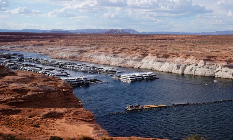
Last year water levels on Lake Powell, a reservoir on the Colorado created by the Glen Canyon Dam, fell to their lowest level since 1969.
As of this month, over 99 per cent of the Colorado River Basin ranked between “abnormally dry” and “extreme drought” conditions, according to the US government’s drought monitor.
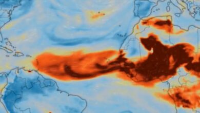
As the world moves further into the climate crisis, those trends are likely to deepen. By 2050, the report says, water in the Colorado could drop a further 10 – 30 per cent.
A separate study in 2020 found that river flow along the Colorado drops about 9 per cent for every degree Celsius of warming. This is spurred partly by reduction in snow cover – which would reflects the sun’s rays – and prevent the land from drying out, a drop not entirely counteracted by an increase in rain.
Historically, the river’s water supply and allocation have been governed by the 1922 Colorado River Compact, signed by the seven states that overlap the river’s watershed: California, Nevada, Arizona, Colorado, New Mexico, Utah and Wyoming.
These states are increasingly trying to rectify water shortages. In 2007, a set of interim guidelines sought to address drought conditions, and a further drought contingency plan was signed in 2019.
However these plans will expire in 2026, and states will need to agree on a new framework before then — a matter which is likely to be complicated by further stresses and uncertainties of the climate crisis.
Along with states and federal agencies, Indigenous groups are key stakeholders on the region’s water issues. The American Rivers report notes that tribal nations have a dearth of water infrastructure and have been historically left out of water management decisions.
A separate report from a consortium including American Rivers offers some suggestions for solving the Colorado River crisis.
For one, cities, industry and agriculture can step up water conservation efforts. In addition, the report notes, covering reservoirs and canals could reduce evaporation and conserving local forests and meadows would support natural watersheds.